(NEW information about CORAL data access at bottom of page!)
CORAL will collect and synthesize a range of data to meet two specific science objectives:
- Measure the conditions of representative coral reefs across a range of biogeophysical values (e.g., different water temperatures, light conditions, etc.)
- Establish models of the relationship between reef condition and biogeophysical parameters
Coral reef condition can be reduced to the quantitative measure of the distributions of coral, algae and sand (i.e., benthic cover), as well as primary production and calcification.
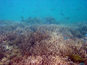
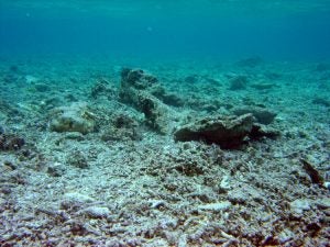
Natural, balanced reefs are mosaics of coral, algae and sand. Together, these benthic types drive the function and structure of the reef ecosystem. However, when corals die, algae rapidly colonize their skeletons. Healthy reefs usually increase coral coverage during recovery from stress, with coral often returning to the pre disturbance level. In contrast, algae and rubble gradually dominate degraded reefs with little or no recovery of coral. With the loss of reef-builders, the carbonate skeleton erodes, ultimately becoming a flat bottom with shifting rubble and sand. This phenomenon is called a “phase shift” in the ecosystem and represents a radical change in the character of the reef. Thus, a key parameter in assessing the condition of a reef is to measure the proportional covers of coral, algae and sand.
- An example of a multi-species balanced reef
- An example of a degraded reef
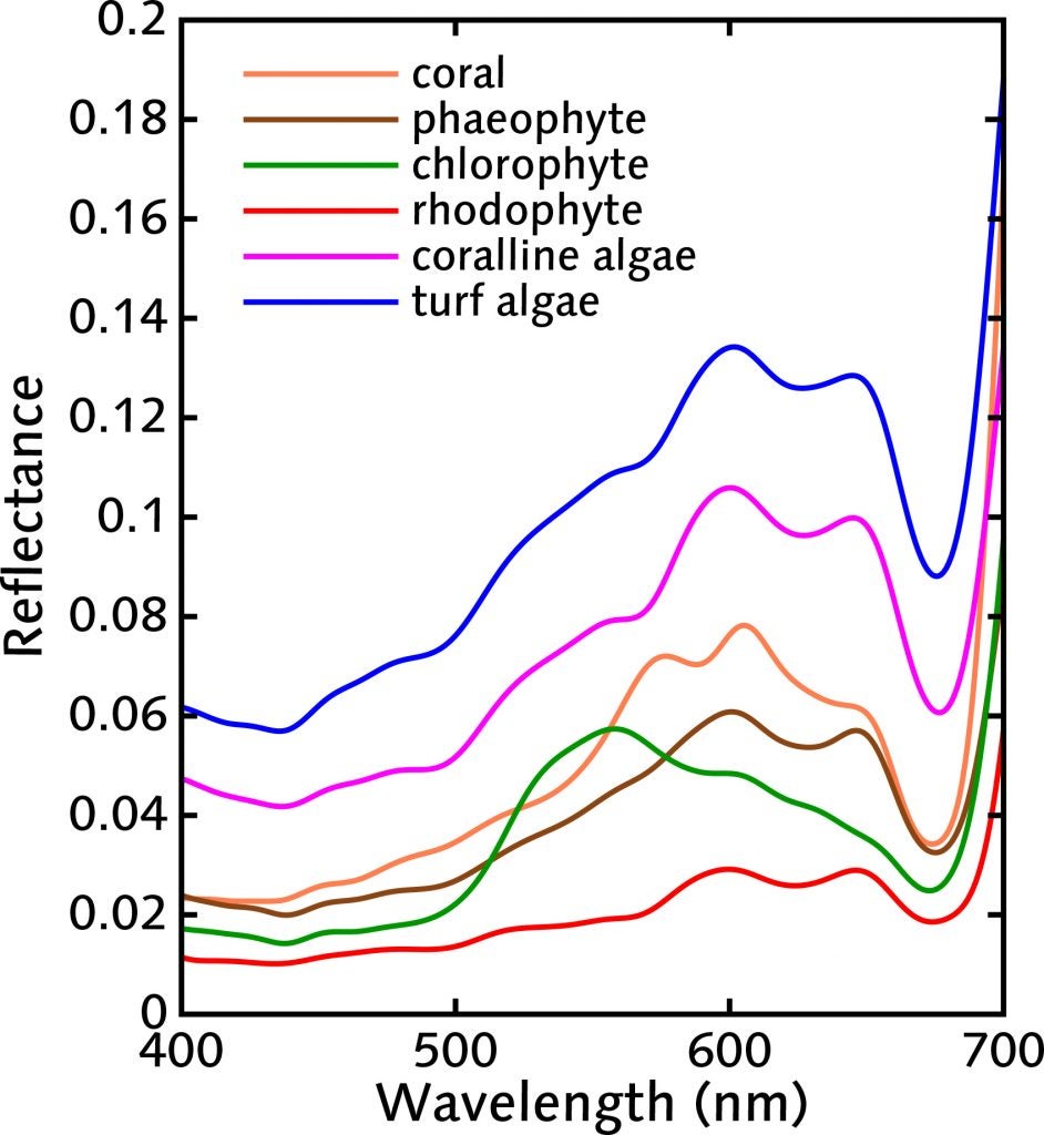
Fortunately, coral, algae and sand each have unique spectral signatures–that is, how much light is reflected as a function of wavelength. CORAL’s approach to determining benthic composition is to measure the spectra of light reflected from reefs, using the PRISM instrument, then to decipher those signals to map coral, algae and sand. CORAL will also conduct intensive in-water surveys to validate the airborne observations.
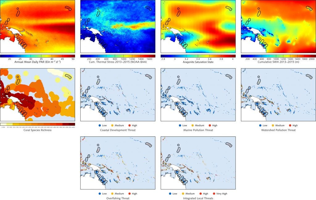
In addition to the airborne and validation data, ten primary biogeophysical parameters have been selected for inclusion in CORAL algorithms based on their recognized influence on reef systems. Data sets describing these parameters will be obtained through a variety of sources, including NASA, NOAA, the Australian Institute of Marine Science and the World Resources Institute. Including these data will help ensure more accurate models relating reef condition to the environment.
NEW: CORAL DATA ACCESS
Airborne hyperspectral imagery across the Great Barrier Reef, Hawaii, Mariana Islands, Palau and Florida can be obtained by visiting https://coral.jpl.nasa.gov/alt_locator/. Currently, you can also directly download at-sensor calibrated radiance and atmospherically corrected water surface reflectance.
In-water validation activities were conducted at Lizard Island (GBR), Heron Reef (GBR), Kaneohe Bay (and other Hawaii sites), Guam, and Palau. The in-water data include benthic cover (via photomosaics), water optical properties (absorption, scattering), remote-sensing reflectance (for the remote sensing people), and benthic community metabolism and calcification. These CORAL datasets can now be accessed by visiting https://seabass.gsfc.nasa.gov/experiment/CORAL and looking at the “Cruises” section at the bottom of the page.
Important tips for people wishing to retrieve CORAL data using the File Search:
1. Under “Keyword Search Filters”, type “CORAL” (or a specific cruise name, like “cah1609“)
2. Make sure you change the default option for “Include Optically Shallow Measurements” to either “Yes” or “Exclusively”, since most CORAL data are flagged
3. If you want Benthic Images, check that option under “Include Associated Files” (i.e., that is unchecked by default since they are large files)
From the search results page, you can pick “Download All” to get one big bundle; otherwise you can browse, plot, or map the contents of individual files.
PRISM flights and Quicklooks for the various CORAL field campaigns can be found at: https://prism.jpl.nasa.gov/quicklooks.html
2016 flights include data from the Operational Readiness Test and the Great Barrier Reef campaign
2017 flights include data from the Main Hawaiian Islands, Guam, and the Mariana Islands


