From June 6-16, 2016 CORAL conducted its Operational Readiness Test (ORT) in Hawaii. The ORT served to guarantee coordinated efforts between the airborne data gathering and in-water validation activities. During this period, the University of Hawaii (UH) Hawaii Institute of Marine Biology (HIMB) served as the base for field operations for all three field teams (optics, metabolism and benthic cover). The G-4 airplane housing the PRISM instrument arrived in Hawaii on Sunday, June 19, 2016 and successfully completed flight lines over Kaneohe Bay (Oahu), a dark optics calibration/validation location, the NOAA MOBY buoy off Lanai, and Molokai.
While the weather was at times both unpredictable and uncooperative, all criteria for a successful ORT were met and both field and flight teams conducted debrief activities to ensure seamless deployment and operations during the next field campaign in the Great Barrier Reef (Australia). Take a peek at the benthic survey team at work in this NASA Earth video:
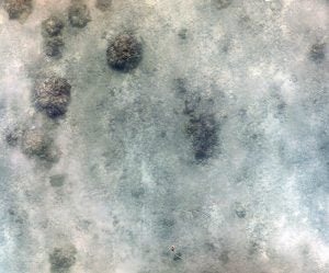
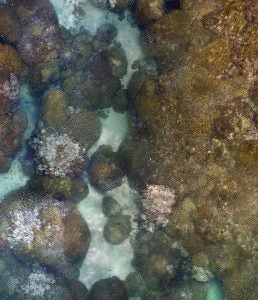
Now that the ORT is complete the images collected by PRISM will be processed through the JPL science data system to generate map products. The in-water data are being processed and quality controlled, after which they will be used to validate the map products. Below are two examples of in-water data products; specifically, high-resolution photo mosaics constructed from hundreds of individual photographs taken within survey sites that are defined larger than the 8x8m pixel as seen by the PRISM instrument:
- A mosaic made from 447 photos of a mostly sandy bottom in Kaneohe Bay, Hawaii
- A mosaic made from 353 individual photos of a patch reef in Kaneohe Bay, Hawaii
ORT Photo Gallery
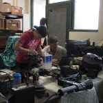
- The CORAL benthic team prepping for fieldwork
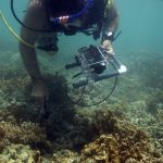
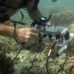
- Dr. Eric Hochberg collecting coral spectra
- A closer view of the spectrometer in its underwater housing
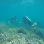
- Divers laying survey markers for benthic habitat mapping
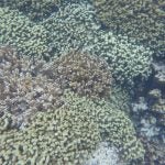
- A patch reef in Kaneohe Bay (Oahu)
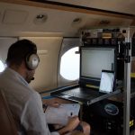
- In-flight meeting aboard the G4
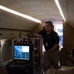
- Ernesto Diaz (NASA-JPL) operating the PRISM instrument during flight
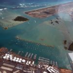
- A view of Hawaii from the plane
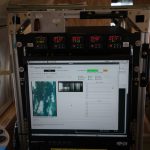
- At the PRISM control helm showing imagery and collected data
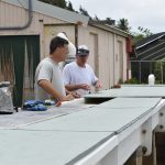
- Dr. Eric Hochberg and Dan Schar (UH) at the flume on Coconut Island
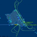
- A map showing flight lines completed by the G4 on 21 June 2016 during the ORT
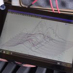
- An example of the spectra collected from a coral sample in the flume
Where is CORAL Now?
The CORAL Flight Locator Tool can be used to track CORAL flights and access CORAL data once it becomes available (after an intensive QA/QC process, which is anticipated to last 6 months for each data set).
Stay tuned for photos of the ORT, additional media releases and blog posts from the NASA Earth Science Team. You can also visit the CORAL “In the Field” page and the CORAL Facebook Page for daily updates, as well as photos, videos and observations from the field.
NASA Earth Blog #6
CORAL Completes First Airborne Look at Coral Reefs Posted on June 22, 2016 at 4:30 pm by sreiny. A high five for a successful science flight. Michelle Gierach (left) greets Coral Reef Airborne Laboratory (CORAL) Project System Engineer Ernesto Diaz and Portable Remote...
NASA Earth Blog #5
The Puzzling Case of Kaneohe Bay Posted on June 20, 2016 at 2:11 pm by sreiny. Kaneohe Bay, with Moku O Loe island at right center. Dredge and fill operations in the bay expanded the island from 12 acres to 28 acres. Credit: NASA/James Round by Carol Rasmussen / OAHU,...
NASA Earth Blog #4
By Carol Rasmussen How We Became CORAL Scientists Posted on June 16, 2016 at 4:38 pm by sreiny. Coral Reef Airborne Laboratory (CORAL) scientists Michelle Gierach and Eric Hochberg identify reef locations for study at Kaneohe Bay on Oahu, Hawaii. Credit: NASA/James...
NASA Earth Blog #3
By Carol Rasmussen Looking for a Few Cloudless Hours Posted on June 14, 2016 at 3:27 pm by sreiny. Kaaawa Valley, near Kaneohe Bay on the island of Oahu, on an overcast day. Credit: NASA/James Round Most offices in Honolulu were closed Friday, June 10, for King...
NASA Earth Blog #2
By Carol Rasumussen In an Airborne Campaign, Why Boats? Posted on June 10, 2016 at 1:59 pm by sreiny. What makes the Coral Reef Airborne Laboratory (CORAL) a game-changer is its airborne instrument. NASA’s Portable Remote Imaging Spectrometer (PRISM) will fly at...
NASA Earth Blog #1
By Carol Rasmussen NASA Earth Thursday June 9, 2016 Coral Mission Starts Work in Hawaii Even in dark glasses, Eric Hochberg is squinting a little in brilliant sunlight glinting from a green ocean. He is driving a research boat across Kaneohe Bay, Oahu, Hawaii, on June...
Traveling to Hawaii
By Ali Hochberg The Operational Readiness Test (ORT) officially begins tomorrow (Monday, June 6), which means that most members of the CORAL team are either already in Hawaii or on their way. Over the course of the next 10 days scientists involved in both the airborne...


